
�������: 1-11 ���鵽�����ݴ��� Systems����ؼ�¼11�� . ��ѯʱ��(0.115 ��)
Academy of Mathematics and Systems Science, CAS Colloquia & Seminars��������ѧϰ����������ƶ������Ӧ��
������ѧϰ ����ƶ� �ھ�����
2023/11/7
������ѧϰ��invariant learning��ָ�ھ������в��滷�����仯���ȶ���������������������н�ģ���Ӷ�����ģ���ڷֲ��⣨out of distribution���ķ�����������ϴ���ЧӦ�Ĺ��Ʒ����������������Լ����ǰ���£�����ѡ����ƫ���Ӱ�졣
Academy of Mathematics and Systems Science, CAS Colloquia & Seminars��Distributed sequential federated learning
�ֲ�ʽ ����ѧϰ ���ݷ���
2023/11/7
The analysis of data stored in multiple sites has become more popular, raising new concerns about the security of data storage and communication. Federated learning, which does not require centralizin...
Academy of Mathematics and Systems Science, CAS Colloquia & Seminars��Optimization problem in remote sensing data processing
ң�� ���ݴ��� �Ż�����
2023/5/4
In this talk, we will introduce some optimization problem in remote sensing data processing. The high dimensional characteristics of remote sensing data, especially hyperspectral data, will not only l...
Academy of Mathematics and Systems Science, CAS Colloquia & Seminars���������¾����������ղ�������̽Դ�о�
������ �������� ���ղ�� ����̽Դ
2023/4/14
���Ľ���۴����������������о�������ϣ��������Ƶ��λ���ع�ģ�Ͳ�Ⱦ��������������ھ������ٵIJ�ͬˮƽɸѡ����ҪӰ�����أ�����DZ�ڷ���Դ���ϣ���һ�����ø�άTVP-VARģ�ͺ��������˷�����ʶ���۾��õķ�����Դ���о���������������۴����ݵ�������������ܼ�ʱ�ط�ӳ�ҹ��������ٵIJ�������������Ч���ش��¼�����µĺ�۾��÷��գ����������ڹ��ʽ���Σ��ʱ���Ǿ�����������Ҫ����Դ���˺���...
Academy of Mathematics and Systems Science, CAS Colloquia & Seminars��A literature review in tourism research based on big data
������ �����о� ��������
2023/5/18
Even at an early stage, diverse big data have been applied to tourism research and made an amazing improvement. This paper might be the first attempt to present a comprehensive literature review on di...
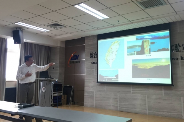
�Ƽ���ר�����㽽��ڷ����������ӿƼ���ѧ��չѧ��������������Ϊ��On MapReduce Acceleration in Multi-GPU systems�����棨ͼ��
MapReduceģ�� ���ģ����
2016/5/11
2016��5��5�գ�̨�徲�˴�ѧ���ڡ�У�L�e���������������������������㽽���Ӧ�������ӿƼ���ѧISN�����ص�ʵ���ң���������Ϣ��ȫѧԺ��������ڵ�������У����ѧ���������ʣ������¿Ƽ�¥1012������Ϊ���ʦ������һ����Ϊ��On MapReduce Acceleration in Multi-GPU systems����ѧ�����档
Automating Laboratory Operations by Intergrating Laboratory Information Management Systems (LIMS) with Analytical Instruments and Scientific Data Management System (SDMS)
laboratory information management scientific data management
2015/5/26
The large volume of data generated by commercial and research laboratories, along with requirements mandated by regulatory agencies, have forced companies to use laboratory information management syst...
Carnegie Mellon, Microsoft Research automate privacy compliance for big data systems
Carnegie Mellon Microsoft Research automate privacy compliance big data systems
2014/6/12
PITTSBURGH��Web services companies, such as Facebook, Google and Microsoft, all make promises about how they will use personal information they gather. But ensuring that millions of lines of code in th...
DATA PROCESSING CONCEPTS FOR THE INTEGRATION OF SAR INTO OPERATIONAL VOLCANO MONITORING SYSTEMS
Hazards Volcanoes Change Detection Monitoring SAR Decision Support Performance Multisensor
2014/4/24
Remote Sensing plays a critical role in operational volcano monitoring due to the often remote locations of volcanic systems and the large spatial extent of potential eruption pre-cursor signals. Desp...
NEW SYSTEMS FOR THE MANAGEMENT OF DATA. THE CASE STUDY OF THE CHAPTER HOUSE OF SANTA MARIA NOVELLA IN FLORENCE
Documentation Image Matching Laser Scanner Multiresolution Virtual Reality Web Webgl
2014/4/25
The technological solutions, made available today, offer opportunities of great interest for the detection in the field of cultural
heritage; instrumentation for the survey and advanced multimedia r...
The Processing of Image Data Collected by Light UAV Systems for GIS Data Capture and Updating
UAVs, Photogrammetry Sensor Orientation DEM, orthoimage GIS
2014/4/22
The collection and updating of 3D data is the one of the important steps for GIS applications which require fast and efficient data collection methods. The photogrammetry has been used for many years ...
�й��о����������а�-��
- ���ڼ���...
�й�ѧ���ڿ����а�-��
- ���ڼ���...
�����ѧ���л������а�-��
- ���ڼ���...
�й���ѧ���а�-��
- ���ڼ���...
�ˡ���-ƪ
- ���ڼ���...
�Ρ���-ƪ
- ���ڼ���...
��������-ƪ
- ���ڼ���...
�������� -ƪ
- ���ڼ���...
֪ʶҪ��-ƪ
- ���ڼ���...
���ʶ�̬-ƪ
- ���ڼ���...
��������-ƪ
- ���ڼ���...
ѧ��ָ��-ƪ
- ���ڼ���...
ѧ��վ��-ƪ
- ���ڼ���...