
�������: 1-15 ���鵽������ѧ���� NASA����ؼ�¼15�� . ��ѯʱ��(0.063 ��)
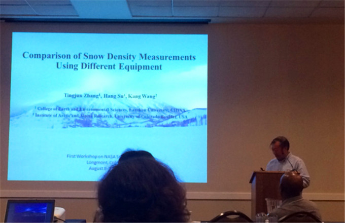
���ݴ�ѧ��Դ����ѧԺ��͢�����ڲμ�NASA SnowExѧ�����ֻᲢ��ѧ�����棨ͼ��
���ݴ�ѧ��Դ����ѧԺ ��͢������ NASA SnowEx ѧ�����ֻ� ����Ȧ�仯 ��������
2017/8/25
2017��8��8��10�գ�����������֣�NASA��National Aeronautics and Space Administration�������SnowEx���ֻ�����������������Longmont�ٿ�������ۼ��˽���λ����NASA�����������ƽ�ʵ���ң�JPL��������ũҵ����USDA��������½�������о�����ʵ���ң�CRREL�������ô�����EC������Ъ����ѧ��University of Mi...
BRIDGING THE GAP BETWEEN NASA EARTH OBSERVATIONS AND DECISION MAKERS THROUGH THE NASA DEVELOP NATIONAL PROGRAM
NASA DEVELOP National Program Applied Science Earth Observations Decision Making Process
2016/11/15
The NASA DEVELOP National Program bridges the gap between NASA Earth Science and society by building capacity in both participants and partner organizations that collaborate to conduct projects. These...
NASA��S PLANETARY GEOLOGIC MAPPING PROGRAM: OVERVIEW
Planetary Cartography Geologic Mapping NASA Missions
2016/11/8
NASA��s Planetary Science Division supports the geologic mapping of planetary surfaces through a distinct organizational structure and a series of research and analysis (R&A) funding programs. Cartogra...
VISUALIZATION OF VGI DATA THROUGH THE NEW NASA WEB WORLD WIND VIRTUAL GLOBE
Data Collection NASA World Wind Free and Open Source Software Volunteered Geographic Information Virtual Globes Web Crowdsourcing
2016/11/8
GeoWeb 2.0, laying the foundations of Volunteered Geographic Information (VGI) systems, has led to platforms where users can contribute to the geographic knowledge that is open to access. Moreover, as...
AN OPTIMISED SYSTEM FOR GENERATING MULTI-RESOLUTION DTMS USING NASA MRO DATASETS
multi-resolution DTM MRO CTX HiRISE CASP-GO
2016/7/27
Within the EU FP-7 iMars project, a fully automated multi-resolution DTM processing chain, called Co-registration ASP-Gotcha Optimised (CASP-GO) has been developed, based on the open source NASA Ames ...
NASA WEBWORLDWIND: MULTIDIMENSIONAL VIRTUAL GLOBE FOR GEO BIG DATA VISUALIZATION
Virtual Globe Data Visualization Big geo-data
2016/7/8
In this paper, we presented a web application created using the NASA WebWorldWind framework. The application is capable of visualizing n-dimensional data using a Voxel model. In this case study, we ha...
2016��3��14����16�գ����й���ѧԺ��CAS�����������Һ��պ���֣�NASA�����졢�п�Ժң�������ֵ����о�����NASA�����ѧ���а�ġ�������CAS-NASA������ȫ��仯�ռ�۲����ֻᡱ��ң�е������������ٿ���
VISUALIZATION OF NASA A-TRAIN VERTICAL DATA ON GOOGLE EARTHTM
Vertical Data Orbit Curtain A-Train Google Earth COLLADA CloudSat CALIPSO
2015/12/28
Google Earth is becoming a popular browser for online geographic-related data and information. It integrates satellite imagery, aerial photography, digital map data, and social-economic data to make a...
2015��9��9����11�գ����й���ѧԺ��CAS������������֣�NASA�����졢�п�Ժң�������ֵ����о�����NASA�����ѧ���а�ġ��ڶ���CAS-NASA��������ȫ��仯�ռ�۲����ֻᡱ�����������ٿ���
PRODUCTION AND DISTRIBUTION OF NASA MODIS REMOTE SENSING PRODUCTS
MODIS Land Products grid products
2015/9/8
PRODUCTION AND DISTRIBUTION OF NASA MODIS REMOTE SENSING PRODUCTS.
Studying Earth Change with NASA ��s Scientific Data Buy Program
The earth changes NASA scientific data
2015/2/4
Studying Earth Change with NASA ��s Scientific Data Buy Program.

2015��1��20����23�գ�CAS-NASAϲ�����ŵ���ȫ��仯�ռ�۲��о�˫�����ֻ����Ჴ�����ӵ������ٿ������ֻ����й���ѧԺ��CAS�����������Һ��պ���֣�NASA�����죬�п�Ժң�������ֵ����о�����NASA�����ѧ���а졣�����й���ѧԺң�������ֵ����о������й���ѧԺ��ظ�ԭ�о������й���ѧԺ�ɶ�ɽ���ֺ��뻷���о������й���ѧԺ���������о������й���ѧԺ�������������빤���о������й���ѧ...
NASA STANDARDS FOR EARTH REMOTE SENSING DATA
Standard Remote Sensing Data NASA Earth Science Global Change
2014/12/30
Earth Observing System (EOS) is one of NASA's large programs for Earth science and global change research. In order to process, distribute, and archive data from EOS satellites and to facilitate inter...

Nicholas Clinton ,Senior Data Analyst,NASA Ames Research Center �C Moffett Field, CA��Pic��
Senior Data Analyst Associate professor
2011/9/21
NAME�� Nicholas Clinton
ְ�ƣ� Associate professor
Email��nicholas.clinton@gmail.com
NASA EARTH EXCHANGE: NEXT GENERATION EARTH SCIENCE COLLABORATIVE
NASA EARTH EXCHANGE NEXT GENERATION EARTH SCIENCE COLLABORATIVE
2014/5/6
The NASA Earth Exchange (NEX) is a collaboration platform for the Earth science community creating new ways for scientific interaction and knowledge sharing. NEX combines state-of-the-art supercomputi...
�й��о����������а�-��
- ���ڼ���...
�й�ѧ���ڿ����а�-��
- ���ڼ���...
�����ѧ���л������а�-��
- ���ڼ���...
�й���ѧ���а�-��
- ���ڼ���...
�ˡ���-ƪ
- ���ڼ���...
�Ρ���-ƪ
- ���ڼ���...
��������-ƪ
- ���ڼ���...
�������� -ƪ
- ���ڼ���...
֪ʶҪ��-ƪ
- ���ڼ���...
���ʶ�̬-ƪ
- ���ڼ���...
��������-ƪ
- ���ڼ���...
ѧ��ָ��-ƪ
- ���ڼ���...
ѧ��վ��-ƪ
- ���ڼ���...