
搜索结果: 1-15 共查到“Cities”相关记录153条 . 查询时间(0.064 秒)
Monitoring Three-Decade Expansion of China's Major Cities Based on Satellite Remote Sensing Images
urbanization satellite remote sensing urban expansion trajectories urban village north-south differentiation
2024/1/12
As the largest developing country, China has experienced dramatic urban expansion since the "reform and opening-up" policy started at the end of the 1970s. In this paper, we monitor three decades of u...
Academy of Mathematics and Systems Science, CAS Colloquia & Seminars:Research on Port Cities' Transportation System and Trade Flows in China
中国港口城市 交通系统 贸易流动
2023/5/5
This paper quantitatively investigates the effect of transportation system on trade flows of four major port cities in China. Due to the significant country-pair heterogeneities in both intercept and ...
中国矿业大学(北京)力学与建筑工程学院与比利时蒙斯大学联合硕士学位项目“Smart Cities and Communities”首位硕士研究生顺利毕业(图)
力学与建筑工程 比利时蒙斯大学 硕士学位
2022/5/27
2021年7月5日,墨西哥籍学生MissPaulina Rodriguez Fiscal于比利时蒙斯大学顺利通过硕士学位论文答辩,论文题目为’Smart cities’ strategies to ameliorate environmental impacts of rapid urbanization in Beijing, China’。该论文是在中国矿业大学(北京)力学与建筑工程学院张小燕...
New software for designing sustainable cities
sustainable citiy city ecosystems improve people's lives
2021/8/4
New technology could help cities around the world improve people's lives while saving billions of dollars. The free, open-source software developed by the Stanford Natural Capital Project creates maps...
交通出行服务国际(网络)研讨会(MMM)第2期,中欧智慧出行服务高端对话―智慧城市与绿色出行(Smart Cities and Green Mobility)
交通出行服务 研讨会 中欧 智慧出行服务 高端对 智慧城市 绿色出行
2020/10/12
我国城市化率已经超过60%,城区人口100万以上的城市已达到90个,机动化的快速发展伴随着交通拥堵和空气污染的日益严重,城市交通管理问题尤为重要。另一方面,欧洲绿色协议正将欧盟进一步转变为现代化、资源节约型和有竞争力的经济体,这意味着更绿色的交通,更智能的交通管理和多式联运。本次网络研讨会将邀请国内外专家分析中国和欧洲城市政府在解决城市交通拥堵、空气质量管理、交通需求管理、公交都市和智慧交通建设等...
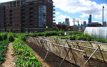
Food systems are fodder for curbing cities' environmental impacts(图)
Food systems fodder curbing cities environmental impacts
2020/3/20
Focusing on urbanization as a key driver of environmental change in the 21st century, National Science Foundation-funded scientists at Princeton University have created a framework to understand and c...

Dual approach to saving sinking cities, bleaching corals(图)
Dual approach sinking cities bleaching corals
2019/10/17
Local conservation can boost the climate resilience of coastal ecosystems, species and cities, and buy precious time in their fight against sea level rise, ocean acidification and warming temperatures...

Oak trees in Southern U.S. cities are natural urban air filters(图)
Oak trees Southern cities U.S. natural urban air filters
2019/10/18
Researchers at the University of North Texas have found that two oak tree species, post oak and live oak, that are widespread across the U.S. South remove black carbon from the urban atmosphere. The f...
郑州大学2019年攻读硕士学位研究生自命题有机化学考试大纲REATING SUSTAINABLE CITIES THROUGH DISASTER RESILIENCE IN TURKEY
郑州大学 硕士学位 研究生 自命题 有机化学 考试大纲
2019/4/19
郑州大学2019年攻读硕士学位研究生自命题有机化学考试大纲。
CLASSIFICATION OF THE STRUCTURE OF CITIES THROUGH MID-RESOLUTION SATELLITE IMAGERY AND PATCH BASED NEURAL NETWORKS
Convolutional Neural Networks (CNN) Autoencoders Sentinel 2B Indian Cities
2019/2/28
The studies in the classification of the urban spatial structure have been essential in deriving insights into the land cover and the built typology which helped in the estimation of energy consumptio...
GEO-VISUALISATION AND VISUAL ANALYTICS FOR SMART CITIES: A SURVEY
Geo-visualisation Data analytics Spatial data Smart cities User interaction
2018/11/9
Geo-Visualisation (GV) and Visual Analytics (VA) of geo-spatial data have become a focus of interest for research, industries, government and other organisations for improving the mobility, energy eff...
MODELING CITIES FOR 3D_GIS PURPOSES
Geometric modeling CityGML 3DGIS QGIS Rhinoceros 3D FME
2018/11/9
3D Geographic Information Systems (3D GIS) are systems that are capable of making spatial analyses that consider the tridimentional and semantic representation of objects. These systems make these ana...
THE URBAN HERITAGE CHARACTERIZATION USING 3D GEOGRAPHIC INFORMATION SYSTEMS. THE SYSTEM OF MEDIUM-SIZED CITIES IN ANDALUSIA
Cultural Heritage Intermediate Cities Urban and Territorial Studies Urban Parameters
2018/11/9
The primary objective of this paper is to approach the use of the 3D Geographic Information Systems (3D GIS), as an instrumental tool that allows us to deal efficiently with the extensive amount of in...
GEO-C: ENABLING OPEN CITIES AND THE OPEN CITY TOOLKIT
Open cities Smart cities GIScience participation transparency Open City Toolkit, doctoral programme GEO-C
2018/11/8
The GEO-C doctoral programme, entitled “Geoinformatics: Enabling Open Cities”, is funded by the EU Marie Skłodowska-Curie actions (International Training Networks (ITN), European Joint Doctorates...
MONITORING URBAN HEAT ISLAND THROUGH GOOGLE EARTH ENGINE: POTENTIALITIES AND DIFFICULTIES IN DIFFERENT CITIES OF THE UNITED STATES
Google Earth Engine Urban Heat Island Landsat Land Surface Temperature National Land Cover Database
2018/5/15
The aim of this work is to exploit the large-scale analysis capabilities of the innovative Google Earth Engine platform in order to investigate the temporal variations of the Urban Heat Island phenome...