搜索结果: 1-15 共查到“信息与通信工程 Image”相关记录122条 . 查询时间(0.109 秒)
Academy of Mathematics and Systems Science, CAS Colloquia & Seminars:An active contour model with local variance force term and its efficient minimization solver for multi-phase image
局部方差力项 活动轮廓模型 多相图像 最小化求解器
2023/5/8
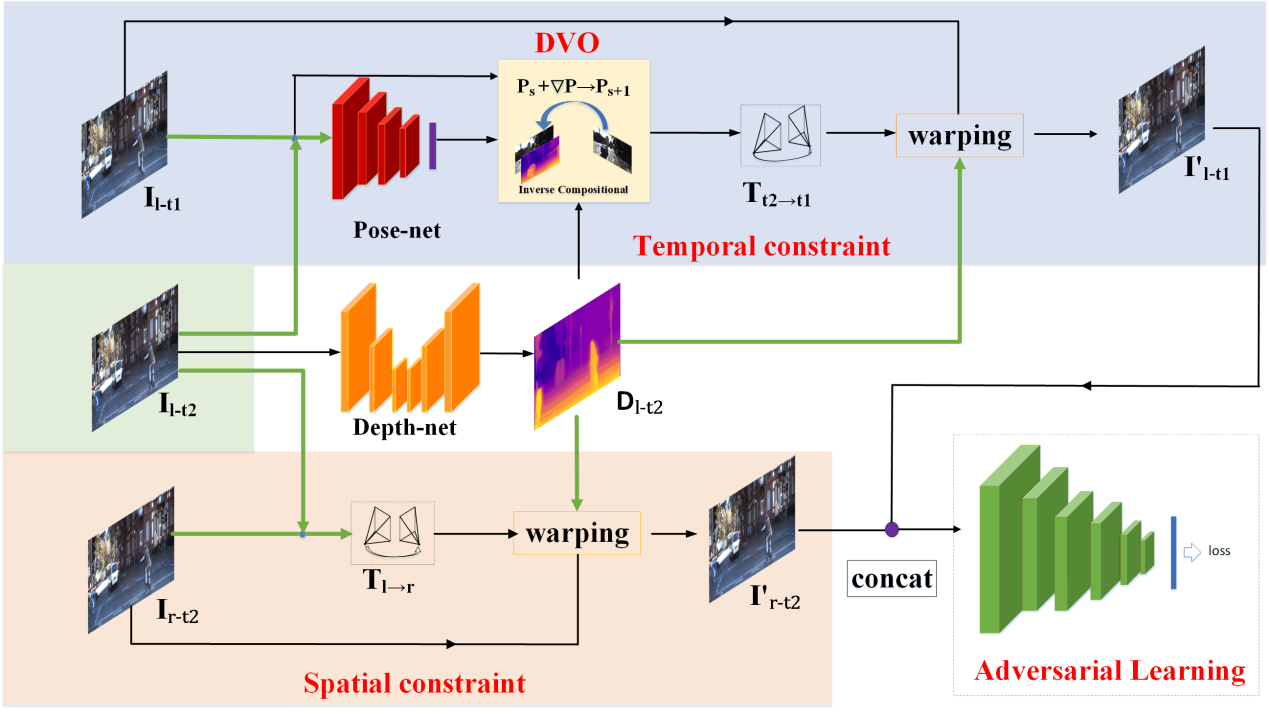
上海工程技术大学电子电气工程学院方志军教授团队在《IEEE Transactions on Image Processing》上发表研究成果(图)
上海工程技术大学电子电气工程学院 方志军 教授 三维场景 深度信息估计 视觉里程计 图像处理
2020/2/17
近日,我校电子电气工程学院方志军教授和高永彬老师指导研究生王安杰在视频序列的三维场景深度信息估计与视觉里程计方面取得最新研究成果,以“Adversarial Learning for Joint Optimization of Depth and Ego-Motion”为题发表在图像处理领域国际顶级期刊《IEEE Transactions on Image Processing》,该期刊由美国电气...
中国科学院信息工程研究所信息安全国家重点实验室操晓春研究员当选为CCF-A类学术期刊 IEEE Transactions on Image Processing 高级领域编辑(Senior Area Editor)
中国科学院信息工程研究所 信息安全 操晓春 研究员 CCF-A类 学术期刊
2019/9/18
2019年8月15日,信息安全国家重点实验室操晓春研究员当选为CCF-A类学术期刊,IEEE Transactions on Image Processing高级领域编辑 (Senior Area Editor),任期3年,全球共31人(大陆地区共两人)。此前,他任职该期刊编委4年,期间获评"outstanding editorial board service"。

首都师范大学数学科学学院X射线CT技术研发团队研究论文被《IEEE Transactions on Image Processing》接受并在线发表(图)
首都师范大学数学科学学院 X射线 CT技术 研究论文 IEEE Transactions on Image Processing 图像处理
2018/7/17
近日,以首都师范大学数学科学学院、北京成像技术高精尖创新中心X射线CT团队赵云松、徐金秋、李宏伟、张朋署名的研究论文“Edge information diffusion-based reconstruction for cone beam computed laminography”(DOI:10.1109/TIP.2018.2845098)被国际顶级期刊《IEEE Transactions o...
GF-3 SAR IMAGE DESPECKLING BASED ON THE IMPROVED NON-LOCAL MEANS USING NON-SUBSAMPLED SHEARLET TRANSFORM
GF-3 SAR non-subsampled Shearlet transform image despeckling improved Non-Local Means
2018/5/15
GF-3 synthetic aperture radar (SAR) images are rich in information and have obvious sparse features. However, the speckle appears in the GF-3 SAR images due to the coherent imaging system and it hinde...
THE LOW BACKSCATTERING OBJECTS CLASSIFICATION IN POLSAR IMAGE BASED ON BAG OF WORDS MODEL USING SUPPORT VECTOR MACHINE
Low Backscattering Objects Bag of Words SIFT features Support Vector Machine
2018/5/16
Due to the forward scattering and block of radar signal, the water, bare soil, shadow, named low backscattering objects (LBOs), often present low backscattering intensity in polarimetric synthetic ape...
THIN CLOUD DETECTION METHOD BY LINEAR COMBINATION MODEL OF CLOUD IMAGE
Cloud Detection Image Features Grayscale Texture Linear Model AdaBoost Classifier
2018/5/15
The existing cloud detection methods in photogrammetry often extract the image features from remote sensing images directly, and then use them to classify images into cloud or other things. But when t...
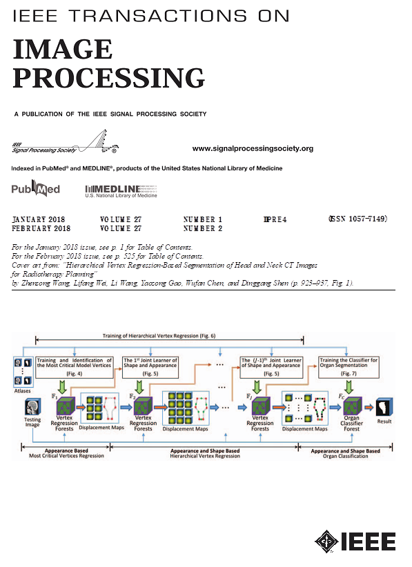
近日,自动化工程学院成像科学与图像处理研究中心王振松老师的研究论文被国际图像处理领域著名期刊《IEEE Transactions on Image Processing》选为2018年2月的封面文章,文章标题为“Hierarchical Vertex Regression-based Segmentation of Head and Neck CT Images for Radiotherapy ...
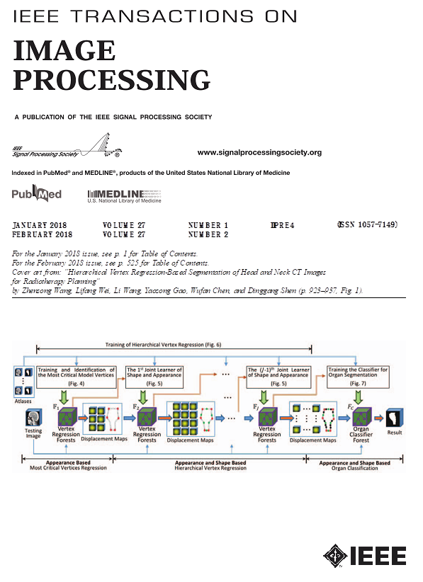
电子科技大学自动化工程学院教师论文入选IEEE Transactions on Image Processing封面文章
电子科技大学自动化工程学院 教师论文 IEEE Transactions on Image Processing 封面文章
2018/4/18
近日,自动化工程学院成像科学与图像处理研究中心王振松老师的研究论文被国际图像处理领域著名期刊《IEEE Transactions on Image Processing》选为2018年2月的封面文章,文章标题为“Hierarchical Vertex Regression-based Segmentation of Head and Neck CT Images for Radiotherapy ...

合肥工业大学教师荣获2017年度 IET Image Processing最佳论文奖(图)
合肥工业大学 教师 2017年度 IET Image Processing 最佳论文奖 图像处理
2017/11/27
近日,我校仪器科学与光电工程学院教师刘羽在《IET Image Processing》上以第一作者身份发表的文章“Simultaneous image fusion and denoising with adaptive sparse representation”,荣获2017年度IET Image Processing最佳论文奖(2017 Premium Award for Best Pape...
Multiscale Shape and Detail Enhancement from Multi-light Image Collections
image enhancement NPR relighting shape depiction bilateral filter multiscale image processing
2016/5/24
We present a new image-based technique for enhancing the shape
and surface details of an object. The input to our system is a small
set of photographs taken from a fixed viewpoint, but under varying...
System calibration, geometric accuracy testing and validation of DEM & orthoimage data extracted from SPOT stereo pairs using commercially available image processing systems
System calibration geometric accuracy testing DEM orthoimage data extracted SPOT stereo pairs
2016/5/20
The paper describes the comprehensive testing of the digital photogrammetric modules forming parts of the image processing systems available from a number of remote sensing system suppliers - PCI, ERD...
A Review of Recent Range Image Reconstruction Algorithms
Laser scanning (LIDAR) Reconstruction Computer Vision Comparative analysis Process modeling
2015/12/8
Preparing virtual models by data acquired from indoor and outdoor objects, comprehensively, have been ingratiated with specialists of geomatic science. Since previous years, specialists of computer sc...
Red Relief Image Map: New Visualization Method for Three Dimensional Data
LIDAR Application Visualization DEM/DTM Graphics Representation
2015/12/3
The vast increase of the volume of three dimensional topographic data acquired by Airborne LIDAR extends the possibility of the visualization method. The maximum laser pulse frequency of modern LIDAR ...


