搜索结果: 1-15 共查到“工学 modeling”相关记录781条 . 查询时间(0.264 秒)

New modeling of nuclear device to deflect or destroy asteroids en route to Earth(图)
小行星 核装置 天体物理学
2024/2/1

Scientists use computational modeling to design “ultrastable” materials(图)
计算建模 “超稳定”材料 金属有机框架
2023/6/6

华中科技大学光学与电子信息学院光电学术大讲堂研究生国际化课堂 《Modeling and Control of DC-DC Converters》开讲啦!(图)
田水林 功率变换器 DC-DC变换器
2023/4/17
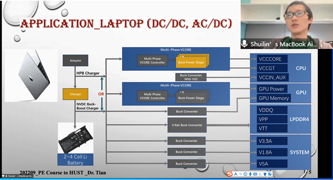
2022年9月18日上午8:00,由光学与电子信息学院承办的光电学术大讲堂暨研究生国际化课堂《Modeling and Control of DC-DC Converters》在东九教学楼B402室顺利开展,特聘专家田水林博士用流利的英文进行了首次4学时的授课,选修该课程的研一学生全部参加了课堂学习,另外有20余名高年级研究生和本科生线上旁听了课程。田博士将为本课程授课20学时,内容包括DC-DC...

Researchers find collaborative flood modeling process effective
Researchers collaborative flood modeling process effective
2020/2/20
Community collaboration and high-resolution maps are keys to effective flood risk management, according to civil engineers and social scientists at the University of California, Irvine and other insti...
WOODEN TRUSSES RECONSTRUCTION AND ANALYSIS THROUGH PARAMETRIC 3D MODELING
Building heritage Terrestrial Laser Scanning Generative algorithms Structural systems reverse engineering Cloud to 3D model comparison
2019/3/4
This paper aims to indicate a new methodological approach, based on generative algorithms, to attempt a more in-depth and transversal understanding of the behavior of these wooden structures. The deve...
AS-BUILT RELIABILITY IN ARCHITECTURAL HBIM MODELING
architectural heritage HBIM As-Built reliability
2019/3/2
The As-Built Model cannot be considered as a simple three-dimensional mould of the studied reality but as a process of analysis, synthesis and communication of architectural complexity including, in a...
VAULT MODELING WITH NEURAL NETWORKS
Automation Machine learning Modeling Neural Network Point cloud Vault
2019/3/1
Nowadays, the digital reconstruction of vaults is carried out using photogrammetric and laser scanning techniques able to capture the visible surface with dense point clouds. Then, different modeling ...
UAV PHOTOGRAMMETRY FOR CULTURAL HERITAGE PRESERVATION MODELING AND MAPPING VENETIAN WALLS OF BERGAMO
Venetian Fortress of Bergamo photogrammetric survey
2019/2/28
In July 2017, the system of Bergamo City Walls was registered in the UNESCO World Heritage List, together with other Venetian fortresses in Italy, Croatia and Montenegro. This important historical doc...
1D-2D MODELING OF URBAN FLOODS AND RISK MAP GENERATION FOR THE PART OF HYDERABAD CITY
Stormwater Urban Flood Modeling Zone XIII SWMM PCSWMM
2019/2/27
Space for water is now becoming guiding principle of urban planning because urban flooding is the major problem facing by most of the cities in India. Urban development in developing countries like In...
MODELING OF PARAMETERS FOR FOREST FIRE RISK ZONE MAPPING
Criteria Based Weight Risk Zonation Fire sensitivity Topographic map AHP
2019/2/27
Forest fire has been regarded as one of the major reasons for the loss of biodiversity and dreadful conditions of environment. Global warming is also increasing the incidence of forest fire at an alar...
SEMANTIC MODELING OF UTILITY NETWORKS IMPLEMENTATION OF USE CASES FOR DEHRADUN CITY
OGC CityGML data model Utility Network ADE data storage utility infrastructure use cases
2019/2/27
The current on-going boom in the field of Building Information Modeling (BIM) and 3D GIS is widely being explored for vast urban related applications, analyses and simulations. Large amount of 3D city...
UNMANNED AERIAL VEHICLE (UAV) SURVEY-ASSISTED 3D MANGROVE TREE MODELING
Mangroves 3D Visualization 3D Modeling Unmanned Aerial Vehicle Assistive Modeling
2018/11/8
3D visualization is a tool that supports geospatial analysis through the application of scientific information. It enhances the quality of standard photography and can be used in many applications. Th...
MODELING CITIES FOR 3D_GIS PURPOSES
Geometric modeling CityGML 3DGIS QGIS Rhinoceros 3D FME
2018/11/9
3D Geographic Information Systems (3D GIS) are systems that are capable of making spatial analyses that consider the tridimentional and semantic representation of objects. These systems make these ana...
SEGMENTATION OF 3D PHOTOGRAMMETRIC POINT CLOUD FOR 3D BUILDING MODELING
point clouds aerial photogrammetry segmentation classification 3D building reconstruction
2018/11/9
3D city modeling has become important over the last decades as these models are being used in different studies including, energy evaluation, visibility analysis, 3D cadastre, urban planning, change d...


